I forgot to write, but yesterday evening I had only two hundred grams of peanuts and a litre of Ice Tea left. That was it. I needed to get down from the mountain and hoped there would be a path as I had seen some stones from old settlements close to where I had camped.
This morning I started walking, and it was the same rush in the bush. Not paying too much attention to the direction I needed to go, I spent more time finding areas that were easier to get through, all the time looking both ways for any evidence of small animal tracks.
After a while I found a small path, and started following it. Sometimes it followed the bottom of a small trench in the ground with lots of dead leaves, so I had to be careful to find the place it left the trench. I hit my sticks on the ground in front of me often just to let the snakes know I was coming their way. Sometimes, the leaves would be 15-20 cm thick, and I didn’t fancy a snake climbing up the inside of my trousers…
Looking at the Google Earth map now, I am slightly disappointed at how flat the area I have been in the last couple of days looks. I am going to publish some pictures here to show you the descent I walked. It looks different on the pictures!
When I got down to a flatter area another slightly larger path appeared, crossing the one I had been following but heading for the steep edge of the mountain. The mountain’s edge had a high drop of more than a couple of hundred metres according to the topo map on my GPS, and it was steep!
The path went to the edge of the drop and I had some reservations when I saw it drop down in front of me. But from experience, these paths are usually well made and safe.
Following the path down was a fantastic experience! High mountain cliffs behind me and on both sides! The path was easy to walk – no danger. After a while, I was in the small town of Liubinbaoxiang. There’s a mouthful for those that don’t speak Chinese…
I waited for two hours to catch a bus that went to Huairou – my new base camp. The bus took two and a half hours to get there. Now I am going to take a couple of days off, sort out my visa and make more pictures and eat lots and lots of fattening food!

Looking back at the descent. The darker rectangle is where I came from.

Higher up, looking back again.
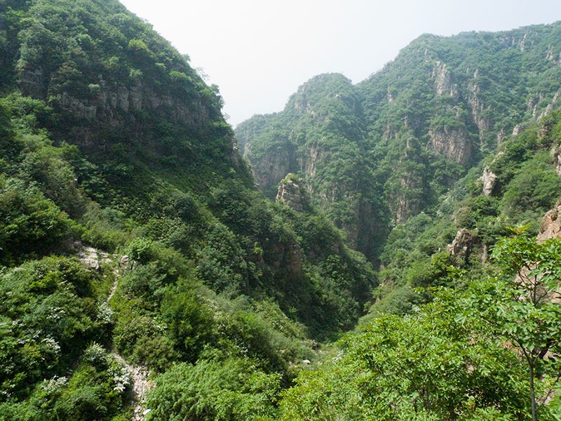
Looking down. You can see a little of the path in the lower left corner.
6 kilometres today
What an adventure! 😀 The photos are great.
Hei Robert!
Takk for flott prat på Skype her om dagen. Ser på bildene av terrenget du går i… Det ser ganske krevende ut!
Men da har jeg håp om gode turer utenfor stier, i Nordmarka sammen, når du er tilbake 🙂
Og jeg setter pris på at du tenker sikkerhet, men det har jeg jo visst hele tiden at du gjør. Du er en flink fyr! Fortsett med å være flink 🙂
Tor